The bad news? For many of you, this warmth will be several thousand feet away...above your heads.
Currently, a high amplitude ridge is building aloft over the eastern Pacific (see map at 500 hPa, around 18,000 ft at 4 PM Thursday). No polar vortex worries for us!
With strong sinking motion in the ridge and the northward movement of warm air on its western side, air temperatures aloft will soar. To illustrate this, here are the temperatures at 850 hPa (about 5000 ft above sea level). This is a good level to look at since it is high enough to get above most surface complications. This sequence is from 10 PM, Tuesday evening through 1 PM on Friday. The darker the orange/red the warmer it gets. During the period temperatures over Seattle warm about 8C (14F).
Here are the forecast surface (2-meters) air temperatures on Thursday and Friday at 1 PM. The warmest temperatures are over the foothills of the Cascades, along the coast and in the Willamette Valley...getting into the 60s! Much cooler at lower elevations near the water. But why?
We can plot the model forecasts for temperature (red) and dew point (blue) over Seattle for the next two days and see the air is drying (dew point is becoming much less than the temperature) and warming aloft, producing a strong low level inversion. Very typical behavior when a ridge of high pressure develops overhead. So there will be cooler air and probably fog/low clouds at very low levels, but if you go up a few thousand feet, it will get toasty.
The upper foothills will be much warmer...so take a hike up Tiger Mt. (2500 ft) near Issaquah and expect sun and warmth. Air descending down the coastal mountains will bring warmth to the coast
And as you can expect, no additional snow. Thankfully, this week has brought our snow pack up substantially: to roughly 80% of normal in the North Cascades to 50% of normal near Mt. Adams. Things rapidly worsen in Oregon to roughly one-third of normal and California Sierra Nevada is a disaster at around 25%. They have a serious problem.
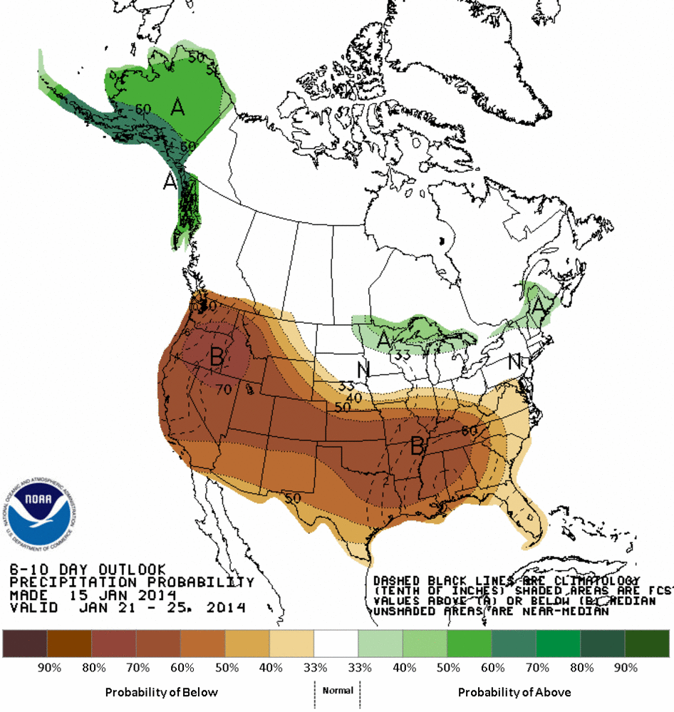
We are now back in a persistent ridge pattern, with the NOAA Climate Prediction Center going for much drier and warmer than normal over the next week (see graphics: brown is dry, red is warm)
Fracking and Ozone
UW Professor Becky Alexander has established a page on the Microoryza crowdfunding web site that outlines her project to understand why natural gas fracking often leads to high ozone values over snow (go here to see it). If you want to learn more about this important project and how you can help it happen, check out the web site. Or take a look at the video below explaining the project.


.gif)


No comments:
Post a Comment