5:30 PM Update: The latest radar shows the convection has moved north and eastward, with some light showers almost reaching Kent, in central Puget Sound. The real heavy showers and intense thunderstorms are over the northern Oregon Cascades and the eastern foothills.
Here is the recent lightning strikes...most are still in Oregon.
The showers will slowly continue moving north and east. The latest NOAA Rapid Refresh runs suggest that little of this shower activity will get north of Seattle. Much of the convection is high-based, with the rain evaporating substantially before hitting the ground. Ok...this is not Twister...but what do you expect here in the Northwest?
........
As suggested by yesterday's models, convection and thunderstorms have developed over Oregon and are now moving northward into Washington. These thunderstorms are driven by unstable air aloft and lifting due to an upper level trough moving northward.
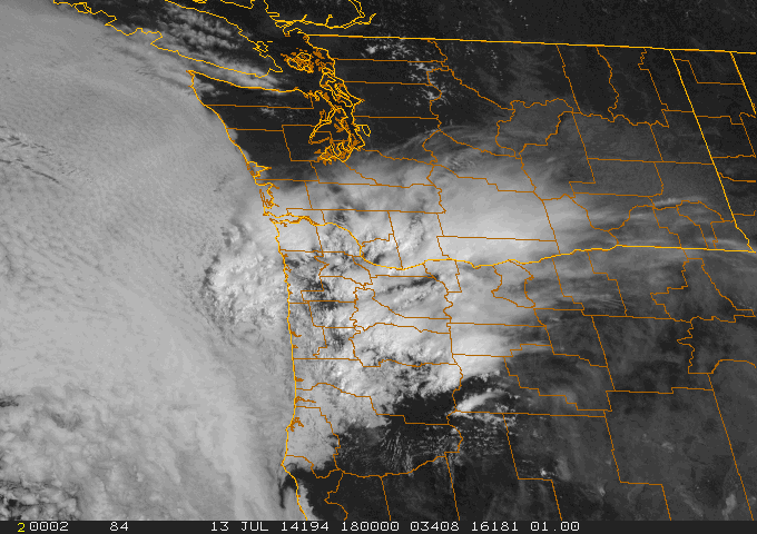
Here is the latest visible satellite image. NW Oregon and SW Washington are being affected by the developing convection, with lots of low clouds offshore. Can you see the convective elements and the cirrus streaming off from to the north and west?
The regional radar is picking up the precipitation from this convection (see image). Some of the rain is not reaching the surface (where it is very light), but there are cores of heavy precipitation (yellows and red) that are moving northward.
A closer-in look from the Salem, Oregon radar shows the stronger cells clearly.
There is lighting with this convection...here is the latest lightning strokes (past hour)
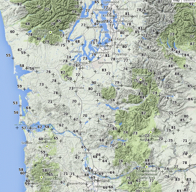
The clouds are having a major impact on temperatures, with a substantial cooling effect over NW Oregon/SW Washington. Here are the 11 AM observations...mid to upper 60s around Portland, but upper 70s to 80F around Seattle. This is a godsend for those adventuresome folks in the Seattle to Portland (STP) bike marathon. They suffered yesterday with temperatures in the lower 90s over much of the route. Today, these will have cooler/cloudy conditions for their entrance to Portland...and I bet they would not mind a few cooling showers (as long as they are not hit be lightning!)
This convective band is moving rapidly northward and the Puget Sound region should see some clouds soon...in fact, the UW cam is showing the leading cirrus already!
The NOAA HRRR (High Resolution Rapid Refresh) forecast system predictonfor 4 PM, shows precipitation over SW Washington and just reaching Olympia.
All convection forecasts are difficult...let's see how well this works out.
This approaching system is of great concern to those fighting the wildfires in eastern Washington. The storms will bring lightning and winds, which can initiate new fires and stoke ones already burning.
And winds should pick up behind the upper level trough (see graphic for 4AM)....which will invigorate the current fires. We don't want a repeat of the Yarnell Hill tragedy of last year, so this situation requires constant monitoring between weather support and ground crews fighting the fires.
Global Warming, the Media, and Coal Trains
I will be giving a talk in Friday Harbor and Eastsound, sponsored by the San Juan Island and Orcas Is. libraries.
I will be discussing the serious threat of global warming, how the media is generally doing a poor job in educating about this issue, and how mankind is really not taking it seriously (e.g., the coal trains).
Friday Harbor: July 22nd, 6:30 PM, The Mullis Community Center, 589 Nash St.
Orcas Island: July 23rd, 5:30 PM, Orcas Center


No comments:
Post a Comment