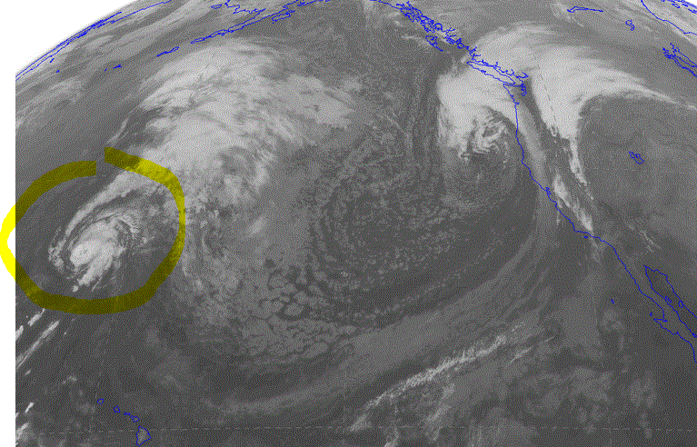
The visible satellite image this afternoon showed an impressive cyclone off of the Northwest coast. You see the spiraling clouds nearly due west of Washington State? That is where the low center is.
Here is a closer view of the low center:
The front projecting from this system is now moving onshore over us and the rain has begun. But what is not obvious is that this storm started as Hurricane Ana, which came close to Hawaii before heading our way.
Here is the official track information from NOAA for Ana. It skirted south of most of the islands as it headed to the northwest. Then near 30N it took a sharp right turn as it was influenced by the westerly winds in the midlatitudes. At this point it began undergoing extratropical transition, changing from a tropical to a midlatitude system.
Don't believe this is the same system that is hitting us now? Let me show you in a series of infrared satellite images. There will be 12 hr apart. In the first two I marked Ana with a yellow highlight. The first one is on Oct 25th at 0000 UTC.
Convinced? The latest WRF model forecast for 11 PM tonight shows that the storm is quite large but not as deep Saturday's system. It also is headed for BC. Many of you will be disappointed that we will not get a big windstorm from it. The City Light lineman will be pleased.
Ex-tropical storms have occasionally hit the Northwest. In fact, some of our most intense and famous storms had their origins in the tropics. The ultimate example? The Columbus Day Storm of 1962, which began its life as Typhoon Freda (a.k.a Frieda).
So cancel your trip to the tropics. The tropics is coming to you! And the tropics are wet, as we will be during the next day (24h rainfall ending 5 PM Tuesday is below).


.gif)


No comments:
Post a Comment