Their gamble paid off, big time. Today, substantial rain, associated with easterly flow circulating around a low pressure area east of the mountains, drenched the inland empire, with many locations enjoying 1-2 inches of steady rain this morning and early afternoon. In contrast, the usually wetter western sides of the Cascades were far drier. How could that be?
This rain was sufficient to thoroughly soak the ground and obviate the need for irrigation for a while, and even provided some water for the Yakima River reservoirs. The weather gods were clearly smiling on the eastern Washington agricultural community.
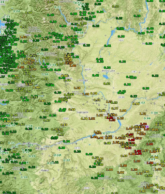
Let me show you some of the data. Here is the 24h precipitation ending 5 PM from the National Weather Service observation site for eastern Washington (the reds and orange colors are the higher amounts, click on map to enlarge). Nearly two inches of rain fell northwest of the Blue Mountains around Walla Walla and similar amounts occurred over the Horse Heaven Hills above the Tri-Cities. Much of the Roza district had over an inch, and substantial amounts fell over the eastern slopes of the Cascades.
The daily precipitation from the WSU Ag Weather network shows a similar situation (see map) with over two inches south of Benton City. A dry wheat farmer from there called me today....he was a very happy fella.
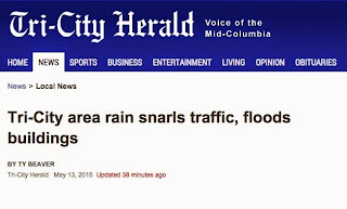
The rain was heavy enough that some roadways were flooded, as were some commercial districts (see article below).
This situation was relatively well forecast by the models several days ago (my past blog is proof!).
So why so much rain on the eastern side compared to the west of the Cascades?
The winds in the lower atmosphere over eastern Washington were from the east or northeast, not the normal westerly direction. The cause? A small, but intense, low pressure system moved northward east of the Cascades today, as illustrated by a weather map for around 5000 ft valid at 5 AM this morning (see graphic). This system had a band of moisture that circled the low center, a band that was directed over southeastern WA and NW Oregon.
An infrared satellite image at the same time and a radar depiction at 9 AM, illustrate this "wrap around" plume of moisture.
I am a bit more optimistic than some regarding eastern WA agriculture this summer. Our region is undergoing a snowpack drought, not a precipitation drought. Reservoir managers have stored more water than usual. And, how do I say this diplomatically? Some farmers have wasted water, including spraying during mid-days when evaporation is huge. As noted in a recent radio segment by NPR's Ana King, some farmers/orchard owners are switching to drip irrigation, saving as much as 50% of the water. Improving irrigation technology will take a few years to put in place, but the long-term impacts on water use could be huge.


.gif)


No comments:
Post a Comment