In 1944, weather forecasting was a primitive enterprise. There were no weather models, no weather radar, no weather satellites and no weather buoys. Weather prediction was a subjective art and highly driven by the available observations. And it turns out that the Allies had a huge advantage with access to far more observations upstream (to the west and northwest) of the English Channel, and this made all the difference.
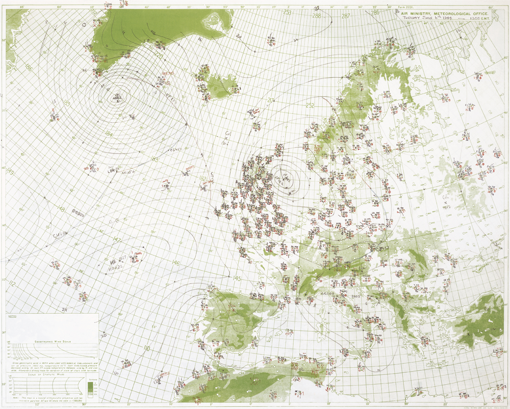
Let me illustrate. Here is a weather map for June 6th available to the Allies. Lots of observations over England, several ship reports over the Pacific, and at land stations on Ireland and Greenland (and North America as well). The British had cracked the German Enigma code and thus they had access to weather observations over Europe. The pressure analysis on June 6th is also shown, indicating a strong storm near Greenland and NW of England.
A map produced by the German weather service had few observations over the Atlantic and as shown below, not many over England. They were clearly underplaying the low to the NW of England
Weather data over the Atlantic was crucial for European weather forecasting and the battle for weather data was decisively won by the Allies. Weather observations were taken by Allied ship convoys and aircraft enroute from North America. Most of the land areas surrounding the Atlantic were controlled by the Allies. The Germans, desperate for upstream weather data, attempting to secure weather information covertly sent U-boats out with automated weather stations. In fact, the only known German military operation in North America was the secret landing and weather station erection in Labrador, Newfoundland. Known as Weather Station Kurt, it ran on batteries for 6 months, and was not discovered until 1977 (see image of it, now in a Canadian museum)
Even more fascinating is that German weather reports were critical for the breaking of the German code system, which made use of their Enigma machine. The allies were able to secure the German weather codes by boarding German weather trawlers and submarines, and then knowing the message could determine the workings of the German Enigma hardware.
Allied forecasters convinced Eisenhower to cancel the invasion on June 5th due to strong winds and clouds associated with that low that ended up NW of England the next day. They believed that high pressure east of Spain would move in for much of June 6th, providing satisfactory conditions for the invasion (see map below)
An analysis of winds and clouds (shading) using a modern meteorological data assimilation system shows the conditions at 6 AM Greenwich Mean Time on June 6th: modest westerly wind and lack of clouds on the Normandy beaches, a necessity of close air support of the invasion force.
There were many heroes on June 6, 1944 but is should be noted that meteorologists played an important role in the establishment of a successful beachhead that day.


No comments:
Post a Comment