Take yesterday. Here is the precipitation for the 24-h period ending at 9 AM Tuesday morning. Over 4 inches on the southwest side of the Olympics, but only a few hundredths to the northeast of the Olympics. Yes... more than 400 times more precipitation on the southwest than the northeast side!
Also more than 4 inches on the windward side of the Cascades and a few hundredths on the eastern slopes.

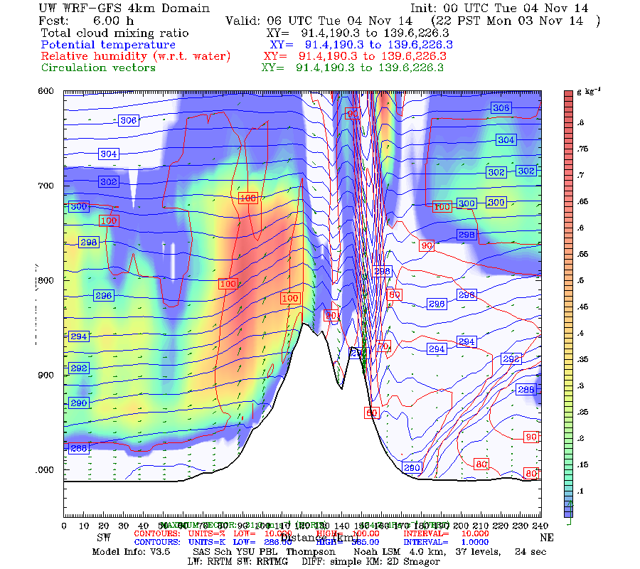
Interestingly, the driest conditions were very close to the Olympics, on the eastern slopes. Why? Because downward motions were very strong there. To illustrate this , here is a WRF model vertical cross section oriented SW-NE across the Olympics. The vectors show winds in the cross section, the shading shows clouds, the blue lines is temperature, and the red line in relative humidity. Upward motion, clouds, and 100% RH on the windward (SW) side of the Olympics. Virtually no low clouds northeast of the crests. If you look carefully you can see downward motion and mountain waves downstream of the crest. Downward motions kill clouds and precipitation.
The rain shadow in the lee of the Olympics was obvious in the weather radar. Here is a radar image from 11 PM Monday night. A lot of rain over the region. The rain shadow was quite extensive, extending between the lee (NE ) slopes of the Olympics across northern Whidbey Is. to the San Juans. If you watched an animation, you would see that the rain shadow morphs and changes shape, but generally remains in the same area.

Because of the heavy precipitation on the windward side of our mountains and our strong rain shadows, the Northwest has some of the largest precipitation contrasts in the world.


No comments:
Post a Comment