The storm...I have seen better defined low centers. The low center is in the middle of the swirl off of Oregon.
There will be a major blow tonight over western Washington that will certainly cause power outages for some of you. This event should bring the strongest winds we have seen during the last year, but damage will be mitigated by our leafless trees and the fact that earlier windstorms have done considerable pruning of new growth and weak limbs.
Let me show you the latest sustained wind (not gusts) forecast every 3 hours of surface (10-m) winds and sea level pressure from the UW WRF run starting at 1 PM (2100 UTC). The Oregon coast gets hit hard...something we have been saying for while. The storm slowly weakens during the day, but there is plenty of punch left in it as it crosses the NE tip of the Olympic Peninsula
4 PM
7 PM
10 PM
At Point Oxford (near Pt. Blanco) on the southern Oregon coast the winds are increasing rapidly, gusting to 60 knots (69 mph)--see below. Pressure is rising, suggesting that the storm is moving away--which agrees with the models.
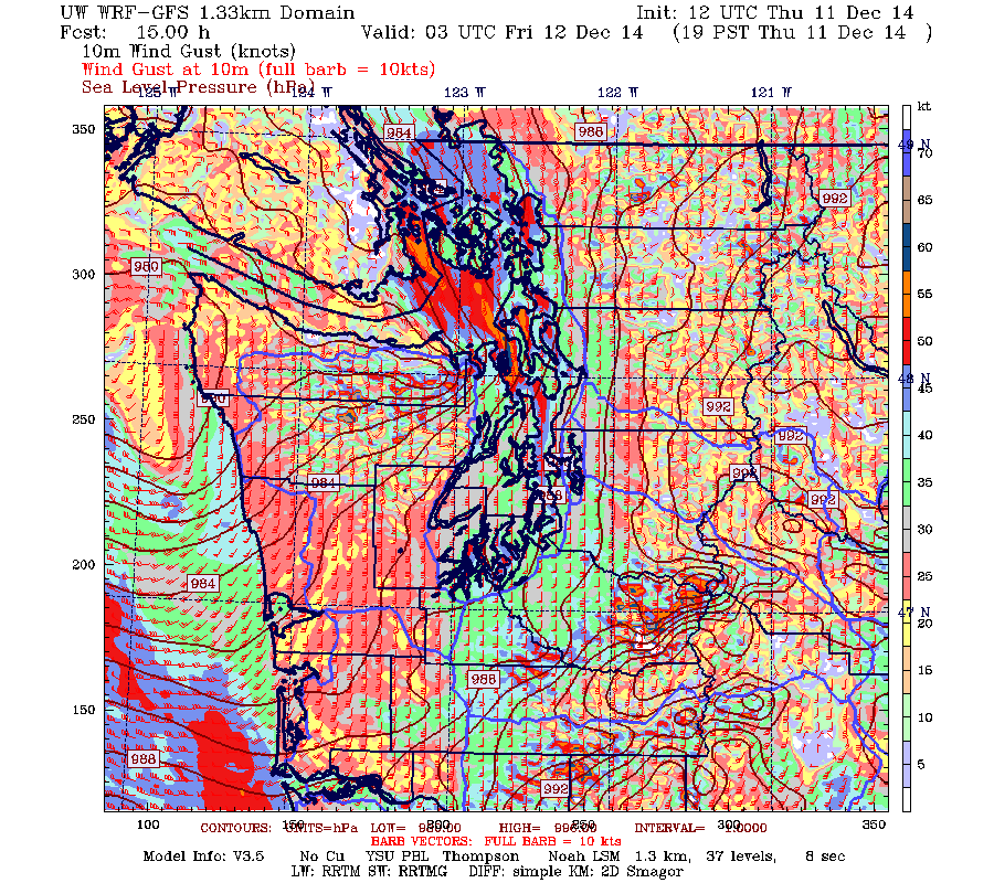
Now, let's turn to the UW Super-Hi resolution forecasts...1.33 km grid spacing--some of the best model resolution of any numerical weather prediction in the country (sponsored by the NW modeling consortium by the way). Let me show you the gusts (in knots, remember 1 knot=1.15 mph). Click on images to expand
At 4 PM, very strong winds along the Washington coast (gusting to 60-75 mph). Long Beach Peninsula is hit hard. Gust to 30-40 knots over Seattle.
By 7 PM, coastal winds back off a bit as the low weakens and is about the cross Tatoosh Is. Strengthening winds over Puget Sound and real bad from Whidbey to Victoria.
At 10 PM, a bit stronger over the north Coast and bad news north of the San Juans. Very strong winds over northern Puget Sound as air surges northward towards the retreating low.
Bottom Line: Nearly everyone will experience gusts to 40-50 mph tonight and some more (coast, near the Sound, NW Washington)
I would not plan any ferry trips tonight and if you need to cross the Sound do it before dinner. I suspect a few hundred thousand folks will lose power in our region, so be ready.
San Francisco Weather Wimpology
The "terrible" and "huge" storm has passed through San Francisco. Here are the max winds during the past 24 h after the worst has occurred. Away from the water their gusts hit 13 to 28 mph. In the forties (mph) near the water and exposed peaks. We had a lot worse around here yesterday, without a big storm!
A very strong front went through San Francisco bringing heavy rain for a few hours, with a few tenths to a few inches depending on location. Northwesteners would yawn at such amounts.
Some San Franciscans have gotten defensive about their weather wimpology: check out their newspaper coverage.


No comments:
Post a Comment