But there were reasons to be wary about this forecast. The European Center model, which is usually superior to the U.S. GFS, had no such strong cyclone. Other modeling centers have found different solutions from the GFS (weaker storm) Furthermore, the U.S. model had the position and intensity of the system varying substantially.
But tonight's forecast is highly consistent with those made earlier today, and the forecast solution of other major centers, such as the UKMET office are now doing something similar.
Finally, we are now only 48h out and it is unusual to have major forecast failures at that time range. But it is also unusual for there to be such major discrepancies between major models this close in.
Let's start by looking at the latest sequence of 12-km UW WRF runs, driven by the National Weather Service GFS model. These are surface charts with the lines being pressure lines (isobars).
10 PM Wed. you see a 982 hPa (mb) low off of northern CA
By 4 AM Thursday it had deepened (975 hPa). That is a very deep low center for our neighborhood.
Intense pressure difference (gradient) to the south and east of the low. Big winds.
By 10 AM Thursday the low had weakened a bit (976 hPa) and hurricane-force winds are hitting the northern Oregon coast. This is very serious stuff.
And then the system weakens substantially as it crosses Vancouver Island Thursday afternoon (4 PM is shown). Strong winds over Puget Sound (30-50 mph gusts perhaps)
Just a small shift in the storm or how it revs up could greatly change the details of this forecast, so PLEASE keep this uncertainty in mind.
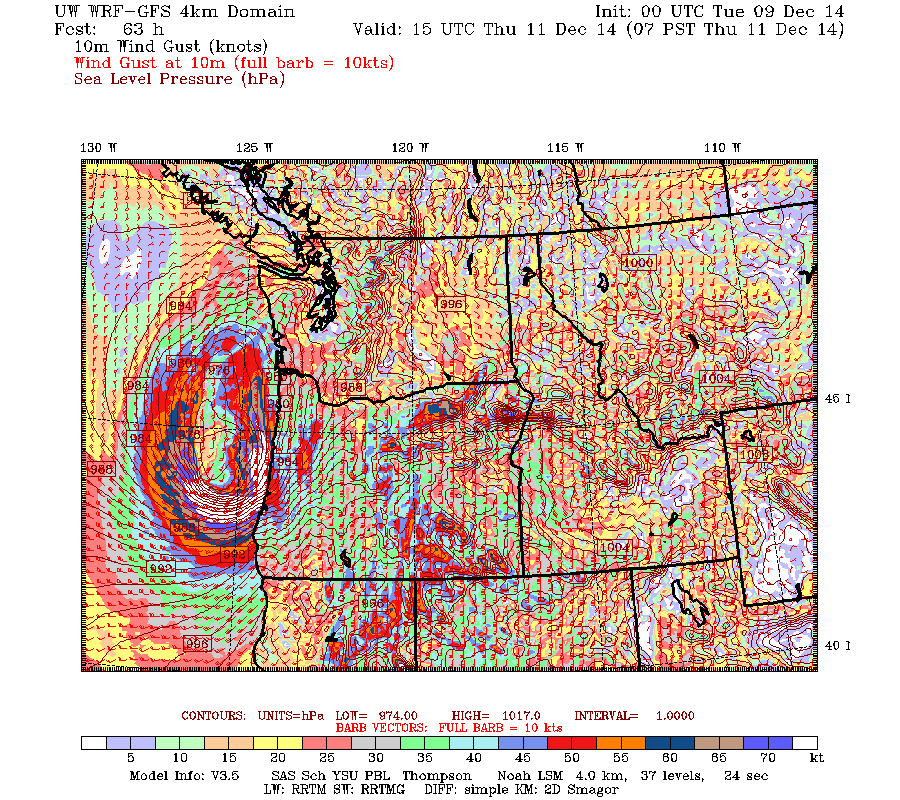
Take a look at the model wind gust forecast for 8 AM on Thursday. How many ways can you say amazing? 75 knot gusts and more. We are talking about power outages and damage on the Oregon coast.
The UK MET office model, which is the second best in the world, is now going for a storm, but a weaker one. Here is the forecast for 4 PM Thursday. A 983 hPa low on the WA coast. A bit different solution and not as strong.
The Canadian Meteorological Center (CMC) GEM model, the fourth best in the world is NOT producing a storm:
At the same time, the European Center model, normally the most skillful, has weaker low center (988 hPa) over SW Washington (shading is relative humidity, solid lines are pressure)
This is a small storm, with substantial uncertainty remaining, but we need to watch it carefully. But tomorrow night we should have much more confidence about what will happen.
And we should not forget the HUGE amount of rainfall that will fall in the next 72 hr ( see forecast). 5-10 inches in the Olympics, on Vancouver Island, and the southern Coast Mountains. Huge amounts in norther CA.
As a result, the NWS River Forecast Center is going for flooding on several western WA rivers, some reaching moderate flood levels. And there is the potential for some landslides.

.gif)


.gif)


No comments:
Post a Comment