One of the best ways to see plumes of moisture associated with atmospheric rivers is to view the integrated water vapor forecasts: predictions of the total water vapor in a column. Atmospheric rivers are generally warm and juicy....lots of water in the column. And when these rivers hit the western U.S. terrain, heavy rain or snow (at high elevations) can occur.
The water vapor image for Wednesday evening shows an atmospheric river reaching the Northwest.
A day later (4PM Thursday) it aims for northern California.
Friday at 10 AM, it is still directed into central/northern CA.
This atmospheric river is going to have important implications for California, some good (filling reservoirs big time) and some not so good (potential for flooding).
Now let's look at the forecast precipitation from the UW WRF model (12km grid spacing). For the next 72h, the NW gets the brunt of the atmospheric river, with 5-10 inches in the Olympics, Vancouver Is., and north Cascades. Northern CA starts to feel the impacts.
Expect some flooding on rivers flowing out of the North Cascades.
During the next 72h the atmospheric river aims directly at CA and the Sierra gets the hardest hit of the past few years, with the model going for 5-10 inches of precipitation on that range.
How much snow in the mountains you ask? For the first 72h, not much snow over the Northwest because the atmospheric river will be quite warm. Sorry. BC does better being farther north.
But snow lovers should not be too concerned. During the next 72h, as the atmospheric river and its associated warmth slide southward, cooler temperatures and substantial snow extend over the Washington Cascades. Importantly, the Sierra, being of higher elevation, gets feet of snow.
The total precipitation from the NOAA/NWS GFS model from now through Tuesday at 10 AM PST? Very wet, with 5-10 inches over the Sierra, Cascades, and coastal mountains.
In short, a water bonanza for the western U.S., topping off Pacific Northwest reservoirs and snowpack and proving a huge influx of water for California. Expect to see major reservoirs, like Shasta, at 80% of normal within a week.
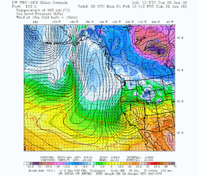
And then there is the potential for a major windstorm. The European Center model brings one into the Northwest in a few days, while the U.S. GFS has a big storm predicted for California on Sunday (see below). Too much uncertainty at this point, so stay tuned. This might not happen.


No comments:
Post a Comment