Sunday morning at 8 AM? Huge ridge of high pressure over the U.S. (this upper level map is for 500hPa)
8 AM Monday? Still here and even stronger.
Tuesday at 8 AM? You guessed it.
This is a very dry pattern for the West Coast, so that once a front moves through on Saturday morning, we will rapidly dry out and stay dry. But the eastern U.S. will become very cold as strong northerly flow moves arctic air southward.
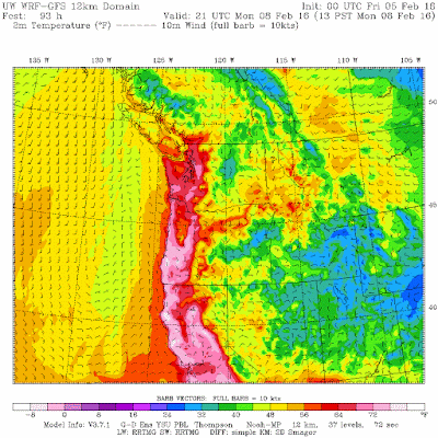
If we get some offshore flow on Monday and Tuesday and don't fog out, temperatures could climb to 60F and above, particularly over the southern portion of WA. With the strengthening sun, it will feel like spring.
To illustrate, here are the temperatures at 1 PM Monday. 70s in California and southwest Oregon. Sixties getting into southwest WA.
Clearly, Ridgezilla has a hot breath!


No comments:
Post a Comment