These fires have also started the mid to late summer smoke season, as indicated by a high-resolution MODIS satellite image from Monday afternoon. Look carefully and you will some subtle smoke around Hanford and over Idaho.
Two days ago, there was even a modest fire in the Olympics, as shown by this aerial shot taken by Ed and Clare Kelm of Roche Harbor. I flew in from the west that day and saw some of the smoke in Olympic valleys myself.
Why the fires now? The key factor was the surge of warmth last week. The plot of temperatures at Pasco, Washington for the past few weeks says it all, with temperatures rising above the mid-90s for 6 days in a row, which drops the relative humidity way down and dries out the surface fuels (like grass).
What ignited the fires? Either careless humans or lightning. Although the last few days has had little lightning, there was plenty a week ago. A lightning strike can produce a smoldering, low-level fire that explodes when temperatures surge.There is no reason to expect an above normal fire season this year. Streamflow, snowpack, and soil moisture are near normal, and the short-term drought indicator (produced by NOAA) shows nominal conditions.
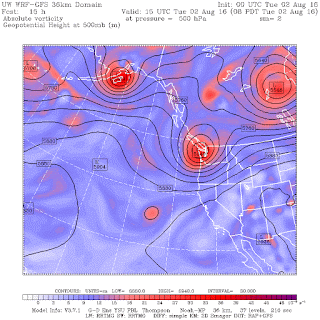
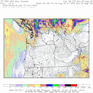
And as noted by previous blogs, an upper level trough is bearing down on us (see upper level map for today at 8 AM) and we expect precipitation during the next day or so in the mountains and western
Washington (see 72h totals below). We do expect some lighting with the rain, so that could initiate fires.
We do appear to be in a cooler pattern, with another cool/wet lupper ow ready to move in for this weekend (see upper level map below). Model forecasts suggests that this will be a wetter system (and yes, this is supposedly the driest time of the year).
I suspect that this summer we will end up with below-normal numbers of wildfires and acres burned, due to the relatively moist antecedent conditions and the atmosphere's new and consistent configuration of troughing over the Northwest. Time will tell.


No comments:
Post a Comment