Sunday, January 18, 2015

A Moderate Blow

 Announcement

The Northwest Weather Workshop is the major local meeting to discuss the meteorology of the Pacific Northwest.  If you would like to give a talk during this year's gathering (Seattle NOAA facility, February 27-28), please send me an abstract during the next few days.  More information is found here:
http://www.atmos.washington.edu/pnww/

..........................
There was a well forecast minor windstorm last night associated with a Pacific cyclone that crossed Vancouver Island during the morning hours. Here is a infrared satellite image around 1 AM Sunday...you can see the swirl of clouds associated with the storm offshore.


The maximum winds during the 24h ending 8 AM tells the story.  A number of locations in Puget Sound hit 40 mph, and winds exceeding 50 mph were found on the coast and over portions of NW Washington.  At least 50,000 customers have lost power in the City Light and Puget Sound Energy networks.


The UW WRF model forecasts starting at 4 PM yesterday captured the event well.  Here is the 6-h forecast for 10 PM Saturday... a 989 hPa low offshore with large pressure differences to its south (the solid lines are isobars, lines of constant pressure)

 By 4 AM, the low had moved to Vancouver Island and there was a large pressure gradient (and winds) over western WA.  Wind are still strong at 8 AM, but will decline during the day (although it will still be breezy during the game).
 Yesterday, the storm tapped warm, tropical air, producing a lot of rain.  And there were amazing temperature contrasts across the state.  It hit 60F in Seattle (unnerving to the arctic-dwelling Green Bay Packers) but only in the 30s in eastern Washington, where cold air is trapped in the Columbia Basin bowl.   This cool air was a godsend for Stevens Pass---the cold air moved westward in the pass (pulled by the approaching low) and helped to maintain snow, while higher elevation locations (e.g., Paradise on Mt. Rainier) turned to rain.   They got 16 inches there before it turned to rain.  Good snow over NE Washington as well, such as in Mazama.


Saturday, January 17, 2015

Will Weather Help the Seahawks?

Sunday is the day of the big NFC championship game in which the Seattle Seahawks will face the Green Bay Packers.

What will be the weather at game time (starting a 12:05 PM) and how might it influence the score?  We will take that on in this blog.

The Green Bay folks are going to be exposed to weather outside of their comfort zone.   Here are the average conditions at that frigid, arctic-like location. In January the average, high is in the 20s and the lows below zero.  Also very dry (only about an inch, compared to around 5 inches around here). Green Bay  is used to cold and dry;  they will experience warm an wet.


Today, the Packers, who are in town getting ready, will experience a substantial Pineapple Express, with subtropical moisture, wind, and warm conditions buffeting their practice.  Here is a chart showing the plume of moisture heading right towards us (for 4 PM)


Heavy rain will hit the area today as a result.   The main plume of moisture will move through tonight, but during the game light showers will continue, ensuring that the field and balls will be wet.  Here are the latest UW WRF model forecasts for the 3-h precipitation ending 1 PM and 4 PM Sunday.  The rain won't be heavy but they should be some during the game.  And the rain should lessen as the game proceeds.


It should modestly windy during the game, with sustained winds around 15 mph with gusts to 20-25 mph.  The kind of conditions the Seahawks are used to.

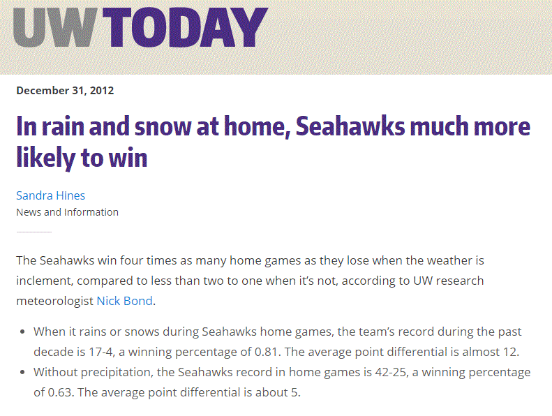
Nick Bond, State Climatologist, and co-instructor with me of the UW senior forecasting class, has examined the correlation of weather with Seahawks performance (see below).  The numbers are impressive: the Seahawks win FOUR TIMES as many home games as they lose when the weather is poor, with an average point differential of 12 during bad weather.


So if you are going to the game, bring a hat and rain jacket, with your earplugs.  The NW weather gods clearly have a favorite.


Thursday, January 15, 2015

Will Snow Return to the Pacific Northwest?

The sense of desperation is palpable among Northwest snow lovers.  The Cascade snowpack is one of the worst in years, many ski areas are closed or running a limited number of lifts.  Snow day closures at local school are daydreams for local kids.

Only local mayors are content.

The first half of the snow season is now over, but should we expect the remainder of the winter to be similar?  I can't tell you how many plaintive emails I have gotten about this topic.   So let's deal with it here.

First, how bad is it?    Let's start with the latest numbers from local ski areas and other sites from the NW Avalanche Center (below).  Only high-elevation Paradise (5500 ft) is above 50%, and not by much (54%).   Others range from abysmal (Hurricane Ridge and White Pass at less than 20%) to terrible (Timberline, Stevens, and Snoqualmie at around 40%).

 Looking at the % of water in snowpack (SWE or snow water equivalent), one notes conditions are poor (less than 50%) in western Washington, Oregon, and the CA Sierra.   Things improve over northeast Washington and eastern Oregon, and are at or better than normal over Montana, Wyoming, and Colorado.


The problem, as I have documented in this blog, has been persistent ridging along the West Coast, interrupted by WARM, wet patterns associated with atmospheric rivers (the Pineapple Express).

So what about the future?

Let me begin with the KEY PRINCIPLE:

Never assume that the second half of  the Northwest snow season will be like the first.

On many years the pattern has reversed, and a poor first half is followed by a bountiful February and March.  Seriously.  This often happens.

Our models are good enough that we don't have to speculate about the next week and the news is moderately good:  there will be some snow during the next few days,

Here is the snowfall prediction for the 72h ending 4 PM on Sunday. Several feet in the north Cascades and good snow into northeast Washington and southeast BC. Unfortunately the Oregon Cascades do poorly except at the very highest elevations.  The reason?  the air mass will be very warm on Saturday as a warm front moves through;  as a result, the Oregon Cascades will be hit by heavy rain (3-5 inches).   Bad for snow.


A little more snow continues in the WA Cascades. the next 24 h (see below), but after that the ridge builds back again and shuts the snow down.
So if you aren't going to or watching  the Seahawks game on Sunday, that would be an excellent day to hit the slopes, particularly from Snoqualmie northward.   Monday will be decent as well for those who are off that day.

Now the bad news.  The NOAA Climate Prediction Center 6-10 day, 8-14 day, 1 month, and 3 month forecasts are all the same and BAD.  Warmer than normal and drier than normal.  Here is the one-month prediction to illustrate.


However, the accuracy of these forecasts is quite uneven-keep that in mind.

What about the National Weather Service's sophisticated seasonal forecast model, the CFS?   You don't want to know.  VERY warm (surface temperatures) the next few months.  And it is going for ridging (high pressure over the west)--not shown here.
What about the large International Multi-Model Ensemble (IMME), which includes many long-range models?   Such a large ensemble should be more skillful. Quite warm for February and March. Ouch.


And there is a lot of agreement among the models, which suggests we should have confidence in this forecast.

The bottom line:  the second half of the Northwest snow season does not look good.  The ski areas will get by...barely...with a bit of snow here or there.  But the snowpack forecast is not favorable and a betting person would wager that the snow depth on April 1 will be below normal.

Ah yes...it looks like light rain during the Seahawks game...which is probably favorable to Seattle.
10 PM Thursday Night It Was Snowing Hard in Snoqualmie Pass

Tuesday, January 13, 2015

It's Raining, But the Radar is Clear. Why?

Saturday afternoon before taking a pre-game run, I took a look at the radar--no echoes over Seattle.

But hitting the trail, it was obviously raining lightly and my sweatshirt got quite wet.

Here is a photo at the time I left, around 2:15 PM, you see the drops on the tree?


Now here is the radar.  No rain over north Seattle where I live.


How could this happen?

And during the big Seahawks game it was clearly drizzling or raining lightly, but the radar showed nothing.

So is something wrong with the weather radar?   The answer is no...  The origin of this discrepancy lies in the type of precipitation and the limitations of weather radar.

On Saturday the precipitation was light rain and drizzle, and these small droplets were descending out of shallow clouds.  The vertical sounding at Quillayute suggested the low-level moist layer was only about 5000 ft thick (the layer where temperature and dew point were the same up to about 850 hPa):

This shallow layer produces small droplets and small droplets are hard to see in normal weather radar.  Also the intensity was light, again providing fewer droplets and thus less of a target.  The droplets got bigger as they descended from the cloud towards the ground.

But even more important is the height of the radar beam.  The closest radar to Seattle is the one at Camano Island, about 70 km (45 miles) away.   As a radar beam leaves the antenna, it rises above the earth surface.  Thus, the farther away from the radar, the higher the beam becomes (see figure).
The lowest radar beam from the Camano Island radar scans at .5 degrees above the horizon (dark blue color aloft).   The beam both rises and expands as it travels away from the radar.  As shown by the figure, by the time the bean gets 45 miles away (over Seattle) the lower part of the beam is at least 2000 feet above the surface, with the center of the beam between 3000 and 4000 ft above the surface.
Thus, the radar beam would miss the lower (and larger) raindrops, the ones that would have better chance of reflecting the radar beam back to the receiver.

Thus, it is not surprising that the radar missed the low-level drizzle that damped the surface.

So why does normal rain show well in weather radar?  Because the clouds and precipitation extend far higher and the drops are larger.

Sunday, January 11, 2015

The Most Boring Weather Day in Seattle History? Did it Influence the Playoff?

Although there was plenty of excitement at Seattle's CenturyLink Stadium as the Seahawks triumphed over the Panthers, Seattle's weather was just the opposite: one of the most BORING weather days in memory.  And it was one of the darkest days in a long time as well.

Here is a plot of the observations on the roof of the atmospheric sciences building at the UW in north Seattle.  The time axis on the bottom is in Greenwich Mean Time (GMT or UTC), but just consider it the last three days ending 9 AM Sunday. The third panel is temperature (black line) and dew point (red line).  Thursday and Friday showed the normal increase in temperature during the day, but Saturday was amazingly boring, with practically no daily (diurnal cycle) and a very slow warming of perhaps 1.5F.    You don't see days like that very often.  It is if the sun did not exist!

Talking about the sun, the last panel shows the amount of solar radiation reaching the surface.  Nice daily variation on Thursday, somewhat less on Friday, but VERY LITTLE ON SATURDAY.  It was a very dark day, with thick, drizzly low clouds over the entire period.

Winds?   Forget it.  They GUSTED to 4 knots yesterday!

In fact, Seattle was the darkest place in western WA on Saturday as shown by the solar radiation observations (SolRad) taken by the Washington State University AgWeatherNet sites (see below).  There was nearly three to four times more solar radiation on the coast! (GRAYL).


The cause of this darkness and unchanging temperatures was persistent low clouds over the Puget Sound region (see visible image at 11 AM).  Thick, low, drizzly clouds.  And lots of fog (but without the stink!).  Thick low clouds act as a reflective blanket:  solar radiation can't get in and infrared radiation from the surface can't get out.  The result is little diurnal temperature variation.


Why no stink?  Because the passage of weak disturbance destroyed the inversion that was capping a shallow layer of cold air near the surface.  The smell lid was taken off Seattle...thank god.

Did the weather aid the Seahawks?   It couldn't hurt.  The Panthers are used to sunny, temperate Charlotte, North Carolina and the dark, dank, drizzly Seattle environment, with the real threat of exotic smells, was certainly intimidating.   Seattle's weather is the Seahawk's 13th man (or woman), particularly since most competing teams are from sunnier locations.


Friday, January 9, 2015

Stink Fog Returns and Hits New Victims

Stink fog has returned and expanded it range, driving trash-talking against Seattle, particularly by Panther's fans and Tacoma residents.   And new insights into the origin of the mysterious odors are now available.

As described in my previous blog and numerous media accounts, a noxious odor reminiscent of either a bathroom or pulp mill hit Seattle, Bainbridge Island, and parts of the Kitsap Peninsula on Wednesday morning.

The coverage of this unfortunate phenomenon has gone national including the NY Post and the Charlotte North Carolina NBC affiliate who suggested that BOTH our city and the Seahawk's game play stank.  They will regret saying that.


But this mysterious odoriferous phenomenon is back and has expanded its range.   Today, many residents of Bainbridge Island were greeted by the now familiar stench.  Biking home this evening  I was hit by it in north Seattle.  And most importantly, large number of Victoria residents were disturbed by the sulfurous smell, as did some residents of Lopez Island.

A major contributor to the regional smell problem has been very light winds and an extraordinarily strong and very low level inversion, which caps pollutants near the surface.  Here are plots of temperature with height in Seattle on Wednesday morning and this morning (Friday).  Very strong inversion and a very shallow layer of cold, polluted air near the surface.  Unusual persistence of an extraordinarily shallow air layer capped by an inversion.


There has been an animated debate of where the smell is coming from.  One idea was that the heavy rains resulted in soggy fields with decaying organic matter, leading to the smells.  But a careful examination of the location of the smell reports indicated few on the eastside (e.g,, Redmond, Duvall, etc.) where it should have been worst.  Cross that out.

Another idea was that low tide exposed smelly tide flats.  This is attractive, since many of the locations getting hit are in the vicinity of water.    However,  the tides have not been unusually low, nor has low tide extended over a particularly long period.  Perhaps a contributor, but it doesn't explain the extended length of the smell.

Another suggestion  was that we were smelling the effluent from the Tacoma or Port Townsend pulp mills.  Perhaps a contributor, but it unlikely that two point sources could have could have produced the smell over such an extended area.

Perhaps the most outrageous suggestion, made by a reporter from a Tacoma newspaper was that Big Bertha, the broken tunnel boring machine under Seattle, hit a huge pocket of decaying matter, and that the smell ascended from the chamber being drilled to replace the broken sections of Bertha.  This Tacoma reporter noted that the access hole to Bertha looks like a giant toilet (see image, it does).


My conclusion, and one supported by my friends at the Puget Sound Clean Air Agency, is that there is no one cause.  The very strong inversion, shallow cold air layer, and weak winds were ideal for maintaining pollutants near the ground.  There are many sources of bathroom and and sulfurous smells that all contribute:  gases released from drains and waste pipes, exposed tide flats, rotting garbage (and Seattle's new composting law ensures there is plenty of that), industrial waste and pulp mills, and many more.    I often get major smell from the nearby Mathews Beach sewer pump station and it spread over thousands of feet.   Reports and my experience suggests the smell is intermittent and localized, suggesting local sources.

In some ways, the low inversion was like an odor microscope, making apparent smells that normally are diffused deep in the atmosphere.

Panther fans can tease us about the smells, but tomorrow a weak front will clean the air, the inversion will lift, and Seahawks will rise ascendant.

Wednesday, January 7, 2015

Stink Fog Hits Seattle

The messages starting flooding in just after midnight last night.   Fog had moved into the region accompanied by pungent odors reminiscent of manure and pulp mills.

A number of local media outlets produced stories about this unfortunate fragrance, such as the Weekly and the Stranger.


Twitter was full of complaints, some perhaps not suitable for a younger audience.

The smell was not limited to Seattle but was also noted on Bainbridge Island and north/south of the city.

My curiosity aroused, I starting looking into this relatively unusual situation.

The meteorology was favorable in many ways.   With high pressure building over the region, a very strong low-level inversion (temperature warming with height) developed over Puget Sound.  Here is the plot at Seattle for a few hours last night.  There was a shallow cool layer 100-200 meters thick which contained the fog and strong warming (the inversion above)
Inversions are very stable layers that act as lids--keeps pollutants and smells concentrated at low levels.

And then there were the winds...they were very weak (as shown by this plot around Seattle around 4 AM, the circles with dots in the middle indicate calm winds).   Weak winds produce little turbulence and vertical mixing.  That helps keep smells in.
So the meteorology was favorable to keep odors near the surface, but what were their origin?  We get this kind of weather configuration all the time with no major smell issues.  What was different this time?

I checked with Seattle Public Utilities... there was no sewer outflows/spills and they said that was true for King County.   The winds were weak, so there was no reason to expect strong air flows from regional pulp mills.

But there was something different this time....we just had major flooding...not in Seattle, but in communities to our east.   Flooding followed by relatively warm temperatures.  

It seems logical.  Large areas were covered with water and during the last day the water had receded.  Some of it farm land.  Manure and some sewage got spread over it.   Might the there have been the release of SO2 (sulfur dioxide) as the moist land stewed a bit in the warm temperatures yesterday?

Smell generation area?

As a check, I looked at the air trajectories (3D air paths) in the UW high resolution model; specifically 24h trajectories ending 10 PM yesterday.  The air came from the east side!


I talked to James Rufo Hill of Seattle Public Utilities and he thought the flooded ground idea was a reasonable hypothesis.  However, such smell scenarios are bit out of my area of expertise (thank god!), so I will leave this to my readers to push this further.

And keep in mind it could have been worse.  In fact, there is a movie (The Fog) about an unusual fog in Oregon that brought not only unpleasant odors, but zombies as well.   I will be content with the smell.


Popular Posts