Sunday, June 7, 2015

As the land warms, our coastal waters don't. Why?

Every year we see the same pattern:  as the Northwest land area warms our coastal ocean cools or stays the same.


It may seem strange, but it actually makes physical sense.

But before I explain, here is the proof.

First, the land temperatures.  Here are the surface air temperatures at Seattle-Tacoma Airport the past 12 weeks (with the normal highs and lows indicated by the red and blue lines).  Temperatures are moving up, with Sea-Tac hitting the season high of 85F yesterday (Saturday).
Lets look at the sea surface temperatures  over the past week at two coastal buoys:  one off the central Washington coast (46041, Cape Elizabeth) and another off the southern Oregon coast (46015).  They are cooling, with the southern Oregon buoy slipping from the mid-50s into the upper 40s!  


What about over the past 60 days?  Here are plots of sea surface temperature for the past 60 days from the two sites (gotten from the wonderful Nanoos web site).  Pretty steady at the Washington buoy, while cooling off of southern Oregon.


Want to see something strange?   Check the sea surface temperature at the NOAA buoy about 300 miles offshore of Aberdeen, WA (46002);  the sea surface temperatures are warming!

What is going on?    Coastal upwelling.

During the spring the regional weather pattern changes, with persistent low pressure off our coast being replaced by high pressure.    Such high pressure tends to bring northerly coastal winds.

To illustrate, here are two weather maps:  a large scale and close-in one from the UW WRF model for 5 PM Friday.  You can see pressure (solid lines), winds (little barbs), and temperature (shading).  High pressure off our coast and northerly winds over the coastal zone.  A summer fair-weather classic.  This pattern becomes dominant in the late spring.


Northerly winds near the surface push the water southward.   But we are on a rotating planet.  This rotation produces an apparent force, the Coriolis Force, that causes the water to deviate to the right of the direction of the force applied by the winds (in the northern hemisphere).   So the Coriolis Force is pushing water offshore.

But there is a problem in the coastal area....the land is there!    No water available.  So to make up for water being pushed offshore, water from below...cold water...has to move up in its place.  We get coastal upwelling, an effect that is limited to the the coastal ocean within tens of kilometers of the shoreline. (see schematic).  Such coastal water is not only cold, but has lower pH (less basic than normal surface water), an issue for the shellfish industry that has their industrial larvae hatcheries  on the coast.


Using coastal buoys and temperature sensors on satellites, we can map out the sea surface temperatures and see the upwelling effects.   Here is a recent sea surface temperature map...you can clearly seen the coastal cooling due to upwelling.   Better take your wet suit if you plan a dip in the Pacific this warm weekend.

Friday, June 5, 2015

When forecasts disagree, who do you trust?

This weekend is going to be a warm and pleasant over western Washington State--you can  take that to the bank.   But the forecasts of various media outlets are not the same.

Let me show you, looking at one location, Seattle-Tacoma Airport, and the forecasts available at 8 PM Thursday.

The Seattle Times is going for 84F on Saturday, 87F on Sunday, and 81F on Monday


The National Weather Service?  83F on Saturday, 84 on Sunday and 78 on Monday

The Weather Channel?  Cooler on Saturday  (81),  with 83 and 80 on Sunday and Monday


In contrast, KING-TV is the same:

Accuweather is relatively cool (82F) on Sunday.

So the forecasts for Saturday range from 81 to 84F.  Sunday ranges from 82 to 87, and Monday from 78 to 81F.     This is a pretty typical range for such forecasts.

So noting that there are differences, who delivers the best forecast?   And why are they different?

One resource to check out is a web site:  ForecastAdvisor.com.   This compare the forecasts of a number of different outlets.   Can I guarantee the results from this website.  No.   But their results are qualitatively consistent with my experience.

So here are their results for last  and this year for Sea-Tac   Meteogroup, a European-based firm, does very well, but so does the Weather Channel and the firm they own:  the Weather Underground.   I often check Weather Channel predictions when I don't have the time to do it myself.  The National Weather Service is substantially less accurate.

Other locations?  Here is their analysis for Spokane and Yakima....quite similar.  Accuweather does decently as well.


Why does a group like the Weather Channel do so well?   Because they have a more sophisticated approach to weather forecasting than the National Weather Service.  But the National Weather Service has one big advantage that sometimes is important:  human forecasters.

All forecasts are based on numerical weather prediction models, with names such as the GFS, UKMET, ECMWF, WRF, and NMMB.  These models start with an observational description of the atmosphere and use the equations describing atmospheric physics to predict the future.

The National Weather Service runs several weather forecasting models, does simply statistic postprocessing to their output  (called MOS, Model Output Statistics), and gives the results to human forecasters, who actually make the predictions that are distributed.  Generally, US forecasters rely on a limited number of forecast models.

In contrast, the Weather Channel has pretty much taken humans out of the loop.   They take the forecasts from many modeling systems and then correct typical errors or biases based on past model performance.  Then they combine these corrected forecasts statistically in an optimal way, weighting the forecasts based on their contribution to making the best forecast.   It is very hard for humans to beat such a sophisticated combination of the best models and statistics, although there are situations when they can.

National Weather Service forecasters can sometimes beat automated (or "objective") forecasts during situations when many of the models fail, when something very unusual happens, when forecasts need to be rapidly updated, or when there are very local effects the models can't simulate and the statistics can't correct for.   Such situations are admittedly unusual, but can be critically important.  National Weather Service forecasters are stationed around the country and thus become experts in their local weather.    They can also consult and advice local governments and businesses--something the national forecast companies do not do.


And I should make something clear.   The commercial weather industry, like the Weather Channel, DEPEND on National Weather Service models and observational data.  To put it another way, the National Weather Service provides the essential weather infrastructure for the private sector..


Wednesday, June 3, 2015

Unusual Early Season Lightning But Few Fires

There has been an extraordinary amount of lighting during the last week or so....far more than usual this early in the season.  Let me show you with a series of maps showing 24-h lightning totals over the region.  These are from the NLDN lightning detection network.

May 23:  Over and east of the Cascades


May 24th:  Lots over the Cascades as cumulonimbus clouds developed over and east of the crest.
 May 25th:  NE Washington and Idaho
 May 26th:  Eastern WA and Idaho
 May 27th:  Ditto
 May 28th
 May 29:  Cascades and NE Washington
 May 30th:  Eastern WA and Oregon
May 31st
 
 June 1
 June 2:  WOW.


The Cascades and eastern Washington have had huge number of lightning hits.  How many major lightning induced fires have resulted?  The Northwest Interagency Coordination Center (NWCC) gives the answer:  none.

How could this be?  Because the ground is too moist.   The Standardized Precipitation Index from the National Drought Mitigation Center for the last month shows the story:  wetter than normal east of the Cascade crest due to all the rain from incessant convection in that region.  Southwest of our region it has been crazy wet.

The Pacific Northwest Significant Fire Potential (from the NWCC) indicates low potential (mainly green) ahead.


The latest NOAA Climate Forecast System (CFSv2) runs for the summer indicates wetter than normal conditions expected for the interior.

Why has the region east of the Cascades been so wet?  Because the large scale atmospheric circulation has been anomalous.   To illustrate this, here is difference from normal (climatology) of the heights of the 500 hPa pressure surface (you can think of it like the pressure pattern at around 18,000 ft).  There was anomalously low pressure over the SW U.S. and nigh pressure over the Gulf of Alaska.  This pattern brought enhanced easterly flow over region, with moisture circulating westward. This pattern has brought unusually heavy precipitation over the SW US, including Texas.

All of this shows why one has to be very careful in predicting a disastrous early wildfire season based on low snowpack:  temperature and moisture are much more important.  But eventually, the ground will dry out and wildfires will return.    The models are predicting warmer than normal conditions for the summer, which would enhance wildfire potential.  But they are also wetter than normal.  That works against wildfires.   But if much of that rain is from thunderstorms, that might enhance wildfire potential.  To put it another way, there is a lot of uncertainty in the wildfire outlook.  We need to be prepared.

Monday, June 1, 2015

Reversing William Shatner's Idea: Moving California Agriculture to the Northwest

A few weeks ago, William Shatner (a.k.a., Captain Kirk of Star Trek fame) offered a solution to California's drought:  move water from the water-rich Pacific Northwest down to California.

He even began a kickstarter campaign to raise the 30 billion dollars necessary to build the pipeline.


Shatner is not the first to suggest that California might raid Pacific Northwest water supplies to help irrigate the Central Valley of California or supply the huge population centers of southern CA.   Such plans were never feasible:  the projects would be too expensive and the water far more costly than other approaches (like desalination).   24th century thinking in the 21st century, perhaps.

But maybe Shatner was on to something, but simply got the idea reversed.

Why move Northwest water to California when you could move California agriculture to the Northwest?

Romulan insanity?   A Borg deception?  A ridiculous offer to Shatner's Priceline?

As Mr. Spock would say,  it is highly logical.

California is an arid region with a large population and an immense agriculture.  Too many people and too much agriculture for even the current climate.    And it will get only worse as global warming increases temperature (more evaporation), reduces snowpack over the mountains, and lessens precipitation over the southern portion of the state (or so our climate models tell us).  Summer temperatures will increase so much that some areas may become too warm for their current crops.


California needs to DECREASE its water-intensive agriculture, including a switch to less water-hungry crops.  Less almonds, for example.

In contrast, the situation if very different in the Pacific Northwest.   Global warming will reduce our snowpack but will modestly INCREASE our total precipitation.  You read that correctly. We will have the same or MORE water.   Our growing season will lengthen as temperatures warm, allowing increased agricultural productivity.     We also have lots of land in eastern Washington that is fertile, but unirrigated.

What does this situation imply for the Pacific Northwest?   Agricultural OPPORTUNITY.

But we have a problem.   Most our precipitation falls in the winter season (we have a Mediterranean climate, believe it or not) and agriculture here is mainly a warm-season affair.   Traditionally, much of our summer water supply is derived from melting snow, but global warming will cause more of our precipitation to fall as rain.  So with less snowpack, summer water supplies could be reduced.


But we can fix this problem in two ways:  (1) create more reservoir capacity, and (2) use our water more efficiently.

Imagine if we greatly increased our reservoir storage, storing more of the bountiful winter rains that will occur in the future.   This will cost far less than Shatner's pipeline.   Use the stored water to massively increase agriculture in the Northwest (including BC).

In short, instead of moving NW water to California for THEIR agriculture, keep the water here and radically expand OUR agriculture.   California could then decrease their acreage in many crops (e.g., grapes).  In other words, MOVE California agriculture to our region, rather than moving our water to California.

It really makes sense.  And wait...there is more.   We could increase our renewable energy capabilities at the same time by getting hydropower out some of the reservoirs as the water is released.   And the water could be used to maintain streamflow and improve fish survival in our rivers and streams.

But before increasing reservoir capacity other steps must be taken.  First, we must stop wasting water. Increased use of drip irrigation, better water distribution, less waste around the farms, and better water delivery are important.   I can't tell you how many times I have driven around eastern Washington, seeing farmers spray water during the heat of the day and strong winds.  The loss due to evaporation would be huge.  Particularly during the afternoon when the winds are blowing strong.


The crop mix may need to be altered to reduce acreage of crops that require huge amounts of water, particularly those of less economic value.  For example, less water for thirsty alfalfa for export to Asia.

Second, the crazy system of senior and junior water rights must be scrapped.  Right now, we have folks with senior rights that are essentially guaranteed water, allowing (encouraging) them to waste some it.   In contrast, junior rights folks, some of which are growing more valuable crops, face cut off (like this year).    Water is a communal resource, much of which was made available by huge public investments.  An annual water bidding system, where folks would compete for the limited resource, would ensure a more rational distribution of water and that water is not wasted on low-value crops.


But after we have optimized our use of the current water supplies, we will probably need to increase the supply, particularly if we are to displace some of California's agriculture.  To do so will require increased reservoir capacity.  Some plans to do so have already been drawn up for the Yakima systems  by a group of farmers, government representatives and environmental groups:  The Yakima Basin Integrated Plan.

Adaptation to climate change is one of the great challenges of the next century.   If I were the Governor I would start with two things:  (1) invest in the research to solidify our estimates of the impacts of climate change on our state, and  (2) establish a bipartisan State Climate Adaptation Board that would recommend actions needed to increase our state's resilience to global warming and natural climate variability.

The ideas presented in this blog reflect the need to deal with natural variability and  to adapt to climate change.  This year is giving us a taste of the future impact of global warming (even though the cause was natural).    No wonder a former starship captain is thinking about it.
____________________

Announcement:  On June 3, I will be on the Seattle Channel's Civic Cocktail with Governor Inslee.  If you would like to be in the audience, you can get tickets at: http://www.seattlechannel.org/CivicCocktail.  They charge, but you get appetizers with their no-host bar.

Saturday, May 30, 2015

Thunderstorms and Convection over the Mountains

During the last week, there have been several days when cumulus clouds were towering over our local mountains, such as the Olympics and the Cascades, while it was sunny and dry over the lowlands.

This is not unusual and is a frequent feature of our summer weather.

Let's talk about it and explore why it happens.  To illustrate this, here are a sequence of visible satellite images from Thursday (May 28th). Starting at 8:40 AM, the mountains are clear, with the white  near their crest being the snow fields.  The extensive white clouds along the coast, the Strait, and southern Sound are stratus/stratocumulus (low clouds).


By 11 AM, you will notice increase white over the mountains...these are developing cumulus clouds.


 By 2 PM, they are much more prominent, with some of them precipitating and developing anvils of ice clouds (fuzzy looking look).


At 4 PM, the clouds are a bit more prominent


The radar image at 4 PM Thursday shows moderate to heavy rain associated with the thunderstorms  over the mountains.  Might have dampened the hikes of a few folks.


We know that some of the cumulus developed into lighting because the lightning detection network showed plenty over the Cascasdes, the Okanogan, the Rockies, and to some degree the Olympics (here is the 24h lightning strikes ending 1 AM Friday).  They are over and immediately downstream of the mountain crests.


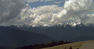
We can view the processes from ground, and what better location than Hurricane Ridge in the Olympic range?  Here is a sequence of images showing the process.


So why do thunderstorms preferentially form over higher terrain?  

There are several reasons.   First, cumulus clouds and thunderstorms are often initiated by an area of upward motion.   The atmosphere is frequently what we call conditionally unstable, which means that without vertical motion the air stay put, but if lifted enough, the air becomes buoyant...rising into cumulus towers.

And vertical motion is greatly enhanced over the mountain crests (see figure).  Air tends to rise up heated slopes (something one often experiences when hiking).   With air rushing up the slopes and meeting near the crest, there is substantial upward motion over the crest.  Upward-moving air will tend to cool to saturation (air cools as it rises), producing clouds.  And if the upward motion is sufficient, instability results as the air become buoyant.


There are other reasons that mountain tops are favored around here.  For example, the lowlands are often flooded by cool, dense marine air (not good for thunderstorms), but the mountain crests are above such air.

If there is westerly (from the west) flow aloft, the convection (thunderstorms) are often blown to the eastern side of the mountains (as happened on Thursday).  The eastern slopes of the Cascades have received substantial amounts of precipitation from mountain thunderstorms the last week or so, something that is aiding the water situation in Yakima County and other eastern slope regions.

Announcement:

I will be giving a talk on the future of NW Weather on June 7th at 7 PM in Hansville on the Kitsap Peninsula:

http://www.brownpapertickets.com/event/1466229