Update Thursday AM: The model solutions have evolved....snow over WA is going to be delayed or avoided...I go blog about it later today. Enjoy the sun and cold....cliff
Some folks west of the Cascade crest are going to receive several inches of snow as a warm front approaches....but exactly who that will be is still not clear.
Cold air has spread over Washington and most of Oregon--more than cold enough to snow if moisture dared to show its face. In fact, a weak upper disturbance brought some flurries to the area today, but no accumulation.
Here is the forecast sea level pressures, surface winds, and lower atmosphere temperatures this evening at 10 PM.
The truly cold air is east of the Rockies, which affords us some protection. Intermediate cold air has reaches eastern Washington, and western Washington, protected by the Cascades, has milder (but still cold air) over us. Temperatures remained below 35F for most of the western lowlands today. There is a good pressure difference across the Cascades, resulting in winds accelerating down the Fraser River gap. Take a look at the max surface winds during the past 24 h over NW corner of WA:
Several locations got to 40-50 mph. The constrained nature of this "jet" of cool, dry air from the interior is obvious. Drive 20 miles north or south of core of the strong winds and you are out of them.
The big weather story will wait until Saturday. We have cool air over us, and a strong warm front with substantial moisture will be approaching. Here is the predicted surface map for 4 AM on Saturday. Cold air still over Washington and northern Oregon, but you see the yellow colors (warm air) offshore. And if you look closely you will see a wind shift from SW to NE winds and a big change in color in the same area. That is an approaching warm front.
Such fronts cause uplift and precipitation. Here is the three-hour precipitation ending the same time--you see what I mean.
As the front approaches, the cold air will hold for several hours, resulting in inches of snow and perhaps a half-foot in some lucky locations. But eventually, the warm front will push through, producing a melting slushy mess for a few hours.
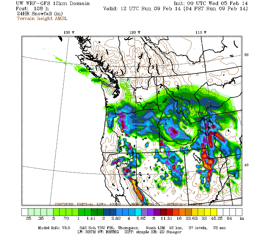
Here is the 24h snowfall for the 24h ending 4 AM on Sunday and 4 AM on Monday. In this solution, the heaviest snow hits Oregon, with the Cascades in both states getting a half-foot. But the snow solutions have not been stable from run to run, so we need to wait to be sure.
We are lucky that this snow event is now occurring on a weekend. And Seattle is far more prepared for snow than cities such as Atlanta, where local officials did not properly prepare their city, even with a decent forecast.
The European social model is a common vision many European states have for a society that combines economic growth with high living standards and good ...
Subscribe to:
Post Comments (Atom)


No comments:
Post a Comment