I know..the title is a bit edgy, but both topics happen to be appropriate today.
First, the all important Mother's Day Forecast.
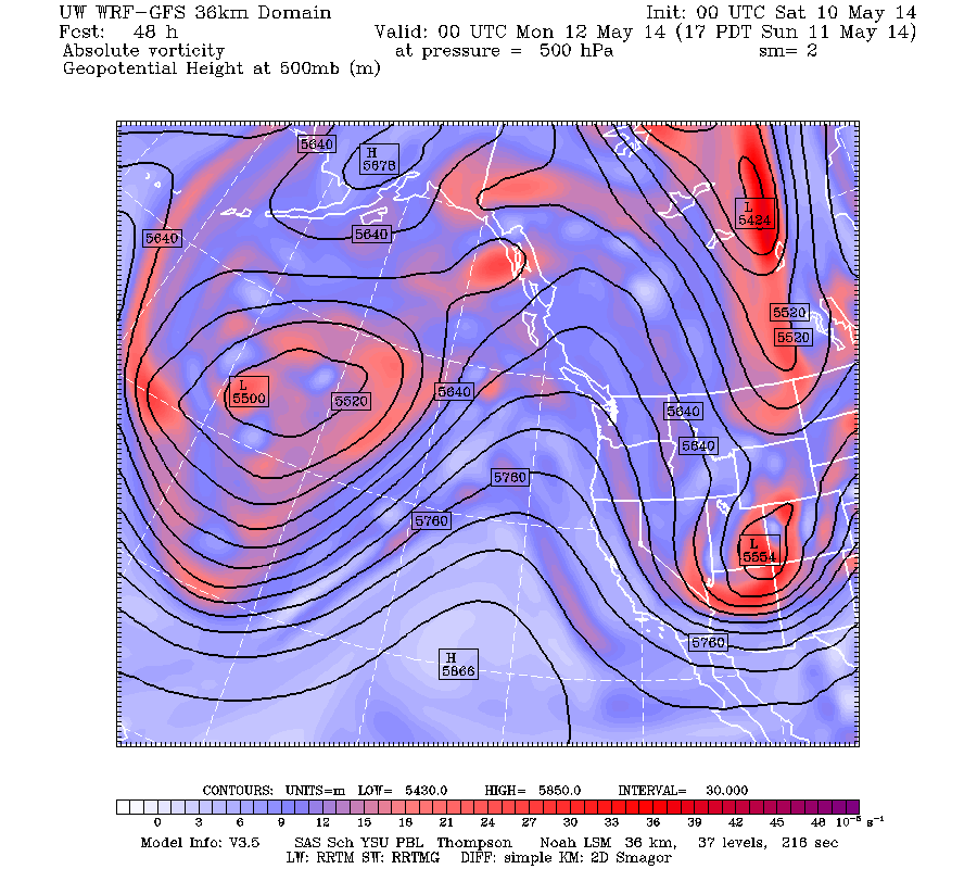
After a period of cool, unsettled weather a ridge of high pressure will develop over the region on Sunday and remain in place through the middle of the week. To illustrate, here is the upper level map at 5 PM on Sunday for 500 hPa (about 18,000 ft above sea level). The pesky trough has moved over the southwest, with the ridge extending north-south over the eastern Pacific.
In fact, the ridge holds in through most of next week....here is the forecast for Thursday morning.
Great Mothers Day gift for all, with temperatures getting into the upper 60s on Sunday and staying in the low 70s through Thursday. No precipitation.
Now, the mammatus clouds. A number of folks sent me pictures of these interesting clouds on Friday AM and I was even able to view them myself. Here is a picture sent to me by Nate Deardorff from NE Seattle.
and here is the picture I took with my smartphone:
These clouds were associated with a fairly strong convective cell. Mammatus clouds forms in situations with negatively buoyant air (translation: air that sinks). I explained these clouds in a previous blog, so check it out if you want to learn more.
Happy Mother's Day
The European social model is a common vision many European states have for a society that combines economic growth with high living standards and good ...
Subscribe to:
Post Comments (Atom)


No comments:
Post a Comment