Those are contrails produced by high-flying jet aircraft.
A blow-up of the section off the Oregon/WA border is below:
Why was this such a spectacular contrail day? Because vast areas in the upper troposphere was at or near saturation (100% relative humidity).
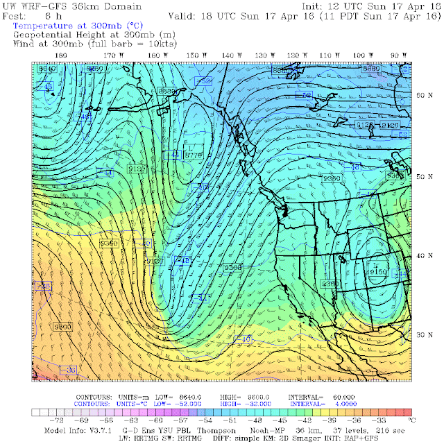
Today there was a ridge of high pressure over the West Coast, as shown by the upper level map at 300 hPa (around 30,000 ft) at 11 AM. \
That is why a vast area was covered with patchy high ice crystal clouds (mainly cirrostratus). The moisture from the jet engine combustion (plus the particles emitted from the burning fuel) helped thicken the cirrostratus, producing contrails. Contrails are FAR less evident in dry air.
We can prove the upper troposphere was near saturation by viewing the vertical sounding (using a radiosonde, a balloon-lofted instrument package) this morning at Quillayate on the Washington coast (see below). The red is temperature, the blue is dew point, and when they approach each other the air is close to saturation. From 550 hPa to 200 hPa (roughly 17,000 ft to 40,000 ft) the air was saturated or close to it. A little extra moisture ensures saturation and cloudiness.
Some folks believe that the contrails shown above are chemtrails, toxic chemicals emitted by a secret U.S. government program. But such ideas have no basis in truth and the fact contrails are more frequent when the air is close to saturation is strong proof of the benign origin of contrails.
Interestingly, contrails WARM the planet. They reflect some solar radiation to space, but their impact on the infrared radiation balance of the planet is larger (they intercept infrared radiation coming up from below, where it is warmer, and emit infrared radiation at a relatively cool temperature).


No comments:
Post a Comment