And this week, we will be warmest before the cool down.
Today (Sunday) the temperatures away from the water will peak in the mid to upper 80s, well above normal.
The plot below shows the temps the last two weeks at Seattle-Tacoma Airport. Really warm before 6 August, near normal for four days, and climbing above normal yesterday and today.
But wait until tomorrow (Monday).
Tonight easterly flow will develop over the Cascades and a thermal trough will move northward. The forecast map at 2 AM Monday at 850 hPa (around 5000ft) illustrates this:
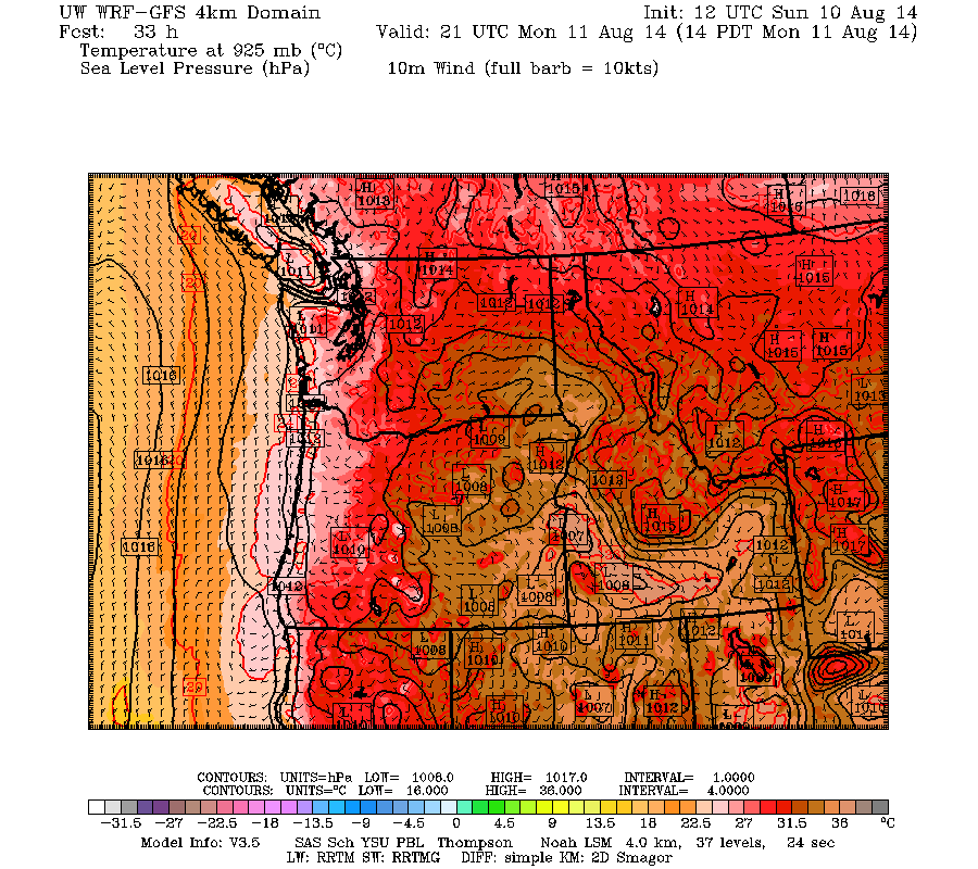
And the forecast surface pressure and low level temperatures at 2 PM Monday show the impacts, with a thermal trough (area of low pressure) extending into western Washington. Red and brown are the warmest temps.
UW Probcast is going for the lower 90s in much of western Washington away from the mountains.
The air will become increasingly unstable over the the Northwest on Monday and continue into Tuesday. In fact, the latest WRF model forecasts indicate extremely high values of potential instability, know as CAPE, for Monday and Tuesday afternoons. Getting over a few hundred is high for western Washington...those afternoons we jump above 1000!
And the approach of an upper trough will initiate thunderstorms on both days, as well as bring more general rain. Here is a upper level (500 hPa) forecast map for 11 PM on Monday. You can see the upper level trough approaching.
Let's look at the 24-h precipitation totals ending 5 AM Tuesday and Wednesday, and the 72 h total ending 5 PM Wednesday. Wow...we are talking serious precipitation. We start with showers over the Cascades and adjacent areas on Monday night/Tuesday morning, followed by much heavier stuff over the northern portion of the State on Tuesday/early Wed. Tuesday should be the more severe thunderstorm/convection day. And the lightning could start more fires in eastern WA.
The 72h totals show .5 to 1 inches over much of western Washington. This is serious rain for August and the first real rain for us after we pass through our low-rain period of late July and early August. The beginning of the end....
And with the rain will come a cooling period down into the 70s.


No comments:
Post a Comment