Here is the view from the Space Needle at 11:10 AM, 11:20 AM, and 11:50 AM...you can see the rain falling out (called virga).
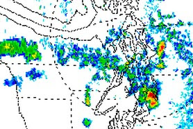
This thunderstorm is associated with a line of convection stretching out into the Pacific (see satellite photo). The thunderstorm is high-based with only modest amounts of precipitation reaching the ground.
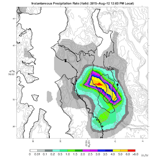
Here is the instantaneous rain rate at 11:48 AM and 12:03 PM...pouring over southeast Seattle..heading toward Mercer Island. Downtown Seattle is only getting a "taste" of the action.
Here is the storm total from Seattle Rainwatch. A lot of folks from Sea-Tac to Mercer Island to Bellevue received .2 inches. Some as much as .5 inches. Those locations can really back off on watering during the next week.
There have been dozens of lightning strikes during the past 1/2 hr...here is one photographed by Aaron Brethorst looking towards the southeast.
Was it forecast? The National Weather Service did have a chance of showers and thunderstorms in the forecasts todya.


No comments:
Post a Comment