"Don't forecast Puget Sound snow until less than four days out or
you see the white of the flakes"
you see the white of the flakes"
Well, our meteorological foe is now cresting the hill and running towards us, so I need to make a call. Here it is.
During the weekend we will have a weak ridge of high pressure over us, bringing cool, sunny conditions: perfect for outdoor activities or catching up in your yard.
Or hit the slopes at Mt. Baker, Crystal, or Mount Hood Meadows.
But by Monday morning at 4 AM, a sharp upper level trough will approach us (see upper level map at that time at 500 hPa (about 18,000 ft), below), a trough that will bring upward motion, clouds, and precipitation. A trough that will drive cool air southward out of Canada.
The surface map (sea level isobars, surface winds, and temperatures near the surface) at 4 AM on Monday shows the vanguard of the cold air, moved along by northerly flow. Blue is cold air, white is intermediate air and yellows and greens are warmer.
Twenty four hours (4 AM Tuesday) later the change is stark and sobering. Cold, modified arctic air has now pushed over our region, although the primo arctic cold is still over the interior of BC...the purple color. Can you see the packing of the solid lines (isobars) over British Columbia? That is that famous ARCTIC FRONT.
The upper trough at this time has amplified and extended down over our region (see map), a pattern quite close to the canonical lowland snow configuration. Perhaps not quite deep and west enough. HUGE ridge to the west in the eastern Pacific. When I see this pattern I worry about snow in Seattle.
The passage of the cold front and associated upper level trough brings precipitation to our area...here is the 24 totals ending 4 AM Tuesday. Light and moderate amounts over the region, particularly over Oregon and the north Cascades and BC interior.
But you want to know...what about snow? Here is the model snow forecast for the same 24 h. Lots of snow over the Cascades. Plenty over British Columbia. And if you look closely, some very light snow extends over the Puget Sound and NW Washington lowlands. Not a lot....but something. The problem is temperature....the air coming off the mild ocean has been warmed at low levels. No snow on the coast for that reason.
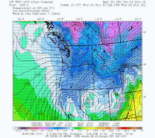
During the next 24 h (through Wednesday at 4 AM) even colder air pushes southward, with precipitation ending from the north (see map at 4 AM Wednesday). Wow...the coldest air we have seen for a long time--even gets to California. THIS IS NOT AN EL NINO PATTERN! The trouble for snow lovers is that by the time the really cold air is in place, precipitation is ending. The classic lowland snow situation.
Snow during that next 24 will far over southern Oregon and northern CA as well as Montana.
So at this point, cold air (lows around western Washington into the low 20s) is pretty certain, as is mountain snow. A lot of uncertainty with lowland snow, but it looks light at this time. But keep tuned ... if the trough changes position by only a few hundred miles, you could have a snowy Turkey season.All local mayors, and particularly Seattle's, should begin preparations for potential snow. You know what happened to Ex-Mayor Greg Nickels...
I will update the snow situation on Sunday or Monday after I talk about attempts to kill the loved KPLU NPR station by UW and PLU administrators.


No comments:
Post a Comment